Could be today, could be tomorrow. Might sneak into next week.
Either way, the PEA is officially out any day now.
Results and reaction could and will have a significant impact on share price and more importantly, where the project will go from here.
The countdown has started to the first Maiden PEA (preliminary economic assessment) for Chidliak.
The information in this study will not only give a huge indication for a green light with PGD mgmt team, but also give that same indication to the market and all stakeholders involved.
Just released - 2016-06-16 - Full Technical report on CH6 and CH7 inferred resource.
Released -- 2016-05-05 - Maiden resource issued for CH-7.
From the latest press release:
"Work on the preliminary economic assessment by JDS Energy and Mining Inc. continues on schedule. Peregrine expects to receive the initial results in late June as previously announced."
The official press release should be out end of June or early July.
~7 to 10 to go for the PEA press release
~7 to 8 weeks - NI43-101 full Technical report
(How to invest in Chidliak.)
Taking a step back, let's see what potential trade off could be in the upcoming PEA.
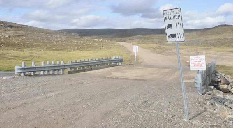
One of the obvious ones is whether an all-season road is built or just an ice road for seasonal supply shipments to site. The all-season road will make the capital costs higher, but will also decrease the operating cost per tonne onsite and have a lot of synergies to make the operation run smoother. The all-season road works a lot better with the new deep water port (available in ~2020) than the more seasonal current sea-lift option. Beyond the economics, one needs to look whether an all season road is technically feasible? The Lac De Gras diamond mines operate on an ice road only. Why haven't they looked at an all season road. The answer is quite clear when you look at the following pictures:
The first one is a picture of Lac De Gras. It is clearly obvious that the NWT and that area is full of lake after lake after water body. To create an all season road in that would require a huge abundance of culverts, bridges, etc. This may be the sole reason why there is no all season road at Lac De Gras.
The second one is a picture East of Iqaluit. There are some water bodies, but mostly a few key streams mixed in with some very small lakes that probably freeze completely during the winter. There looks to be plenty of opportunity to route an all season road from Iqaluit to Chidliak with a few key bridges or culverts along the way. So, it does look like it is very feasible to construct an all season road. This clearly shows why a lot of the pipes in Lac De Gras are under water features as well and those require very expensive dykes to hold the water back. Chidliak doesn't have this problem with its key pipes.


A good question going into the PEA is what value or revenue potential is their in the current inferred resource?
To analyze that, one needs to use a combination of Tonnage, Grade and the third and very important parameter of Carat Value. A valuation of carats is completed in a snapshot of time. One must further adjust that value in time to the current date (in this case May, 2016) using both a rough diamond index and a point in time for the Canadian dollar versus US dollar. The index is a rough use/estimate, in reality, you can get the parcel/model re-appraised.
Below is a chart indicating what the Insitu-Value might look like. Assuming the base case of the diamond valuation model, you end up with about CAD$2.8 billion worth of stones to extract in the mine plan. It is broken down by CH6 and CH7. You can extract a huge amount of value out of the first few years of mining if one was to focus on CH6 and mine out CH7 later on. That has a significant impact on NPV when it comes to the discount rate used

Here is a table that just highlights all the adjustment and valuation ranges and CAD$ conversions that one has to perform to get to as current as possible.

The above chart also highlights (207 vs 157) that CH6 is roughly 25 to 30% higher in value of stones as compared to CH7. If you don't adjust for time and current market conditions, it does look CH6 is 60%+ higher in valuation...but that is not the case.
News release - 2016-04-07 - Resource update for CH6. Then another 45 days for the full technical report.
It has taken about 10 years to get here from the original onsite sampling, but the timeline has gotten ever shorter and the green light for a mine is ever closer.
Key items completed to date:
1 - Bulk sample macro valuation for CH-6 kimberlite (2 years ago).
2 - Bulk sample macro valuation for CH-7 kimberlite. (very recently).
3 - Maiden resource and a first and (now) second update on CH-6 resource.
Items to come:
1 - a maiden resource announcement for CH-7.
2 - Cost estimation, pit design, trade off studies, NPV/IRR - The PEA.
What to look for?
CH-6 - Current inferred resource estimate sits at 3.323 million tonnes for KIM-L material
Estimates range for an additional 1 million to 1.2 million tonnes for KIM-L material.
Here is a chart depicting the area where the current inferred resource exists.

For one, you will notice a carving out on the left side of the blue material. This is actually where the KIM-C material exists. This will not be included an inferred tonnage yet because it has no confirmed valuation ($/carat) associated with it. The PEA will assume this material will have $0 value to it..although reality is actually quite different. So, the 1 million to 1.2 million tonnes of material for conversion is below 120 metres and above 250 metres, in the area where the blue shape is flat (not carved) That whole area will be expanded outwards and be very similar to the top 120 metres.
Of note, the 2015 drill programme consisted of 2 holes to 260 metres depth and they both ended in kimberlite. There may be a chance they extended the inferred material target from 250 metres to 260 metres depth.
CH7 - This kimberlite has no inferred material as of yet, but has some high knowledge TFFE down to 160 metres and some further TFFE (Tonnage for future exploration) down to 290 metres. They had a few of the LDD RC drillholes go down to 240 metres in addition to some core drilling in 2015 down to 220 metres deep.
TFFE ranges from 3.7 to 6 million tonnes, but that is mostly a vertical interpretation instead of an expansive interpretation.
One might say that CH-7 has not had a maiden inferred resource, so it is two steps behind CH-6. This is clearly wrong as both CH-6 and CH-7 were discovered at the same time and have had regular core drilling each year to further define each kimberlite. CH-7 has not had an inferred resource yet because it was missing the key valuation piece that is now available.
Here is an image of what CH-7 currently looks like:

The image above, you can clearly see how the drilling above 160 metres is quite significant compared to the area below. The area in the cyan represents 3.7 million tonnes of material and it is quite possible this will all get converted to inferred material. The area below 160 is questionable. With the core drilling down to 220 metres, that material may all be converted as well. The material all the way down to 290 metres is estimated at around 6 million tonnes. The plan is to convert material above 250 metres. It probably is reasonable to estimate between 4.5 to 5 million tonnes will be converted in the initial inferred resource.
CH-7 also has 5 domains. The majority of the material is KIM-2 and KIM-4. This initial inferred resource will also figure out how many tonnes are in each domain.
The conversion of material is critical for the upcoming PEA and it will have a bottom line effect direct to the revenue part of the PEA. The two kimberlite pipes will both have pits down to 250 metres..so it is a question of how much material has been converted to inferred as that is what resource class needed to be included in a PEA.
This resource update could add upwards of US$600 million from CH-6 and another US$600 million from CH-7 in addition to the existing inferred resource of US$1.5 to 1.7 billion.
This resource update is clearly a Billion $$ resource update. Very material to the project.
This translates into a PEA that has CAD$3.5 to CAD$4 billion in total available material as a revenue input into the economic model with future conversions available to add even more.